- Home
- Your Boats
- Weather
Global and Local Maritime Weather Patterns
Understanding how global weather patterns influence local conditions will help you understand changes to your local climate and sea conditions.
Stay safe and enjoy your time on the water.
The day to day changes in the weather can seriously disrupt our boating, especially for those of us in the middle and high latitudes.
Generally, when we talk about ‘weather’ we are referring to local conditions but these are the result of more general phenomena.
Climate zones.
The
atmospheric conditions and weather patterns which cause these are
more
correctly referred to as ‘climate’.
However, whatever term is used, it is the global weather patterns, with
their
longer term effects which cause the variations in out local conditions.
These atmospheric patterns are generated by the difference between the
temperature of the Polar Regions and tropical latitudes.
As air warms it rises and colder air sinks.
So very basically we have warmed air rising in the tropics and being replaced by the cold air coming from the poles.
However, the water cycle and the Coriolis Effect also play a role in determining how the weather patterns develop.
And we end up with the globe divided into latitudinal bands of weather patterns.
Near the equator is the Intertropical Convergence Zone (ITCZ), or
doldrums.
Either side of that between latitudes of 10 and 20 degrees are the
trade
winds.
Then the high-pressure zones of the horse latitudes lie roughly 30
degrees
either side of the equator.
Next are the temperate latitudes with their variable weather patterns.
Much of the fluctuation in the climate cycles in these latitudes is caused by being between the high pressure horse latitudes and the low pressure zones beyond at 60 degrees from the equator.
Then, beyond that, the poles are dominated by high pressure.
BooksTemperature and Moisture.
Unfortunately
those general trends mentioned above are subject to much
modification.
Even a small change to the atmosphere in one place can grow large
enough to
affect other areas.
The old saying about the beat of a butterfly’s wing on one side of the glob affecting the weather on the other side is, to an extent true.
The general pattern of convection, causes lower air to flow towards the equator while that in higher layers (jet stream) flows towards the poles is also affected by air pressure, humidity, clouds, and rainfall.
Water vapor makes up a large proportion of the atmosphere.
As a result the water cycle has a significant effect on the weather patterns.
Clouds insulate the earth’s surface from the sun, helping to regulate ocean temperatures.
As we all know, the clouds are formed by water vapor evaporating from the surface of the ocean and the warmer the air the more moisture it can contain.
However, this evaporation also cools the surface water and as the water
condenses into cloud or mist the air is cooled.
Also, as the air rises the atmospheric pressure falls allowing it to
expand and
cool as the clouds are formed.
As the temperature and moisture and pressure alters between one place
and
another winds are generated.
On a weather map the pressures are shown by isobars, the closer they
are
together the greater the pressure gradient, and the stronger the winds.
And in their turn the winds accelerate the rate at which all these
modifying
influences move across the surface.
Tropical storms resulting from rapid changes in the tropics can
accelerate and
cause dramatic weather effects over huge areas of the globe.
Local topography will also have an affect on conditions.
The land heats up and cools down more quickly than the sea, so during
the day
air rises over the warm land and is replaced by cooler air flowing in
from the
sea.
And where the coast rises the moist onshore winds are forced upwards, the water vapor then condenses to form a line of cloud along the coast.
affiliate linksGlobal Circulation.
The global effects we have
looked at so far are north south (longitudinal) effects.
However, these are then affected by the Earth's rotation.
This is known as the Coriolis Effect.
This Coriolis Effect or force is the apparent deflection of the
atmosphere as
viewed from the rotating earth's surface.
As the earth spins on its axis, we who are stuck to its surface go with
it, the
atmosphere however isn’t so well stuck to the surface so it lags
behind.
However the atmosphere isn’t completely independent of the earth, it is
also affected by gravity and friction, more so in the lower layers.
The result is that the latitudinal air movement begins to be rotated as
the
Coriolis Effect comes into play.
And this is how those typical circulating weather patterns are formed
and why
they appear to be deflected eastwards.
The global circulation is basically the same in both hemispheres, however there are differences due to the different distribution of land and sea, the greater amount of land mass in the northern hemisphere being yet another influencing factor.
BooksSystems of Weather Patterns.
These circulating weather systems appear mature and decay constantly
around the
globe.
And our weather is largely controlled by these systems.
Low pressure systems are cyclonic in the northern hemisphere, the winds
swirling around the system in a counter clockwise direction while in
the
southern hemisphere they move clockwise.
They are often associated with powerful storms and tropical cyclones
and
tornadoes.
They generally form when the air becomes less dense as a result of
heating.
High pressure systems often occur when rising warn air rises, spreads
out and
when the air cools and sinks back down to the ground.
They are associated with clear, cool weather with the winds flowing
clockwise
around them in the northern hemisphere, counter clockwise in the
southern
hemisphere.
As these systems apparently track eastwards they bring distinct changes in weather conditions.
Fronts.
Fronts are the boundaries between air masses.
Masses of different temperatures, rather than mixing tend to move,
either up
and over or below each other.
The boundaries between different air masses within a depression can
either be
warm fronts or cold fronts depending on which of the air masses is
advancing.
Generally, cooler air will push under warmer air forcing it upwards and
increasing the pressure gradient.
A typical cold front will have a steep pressure gradient with cloud
formations,
ranging from high-level cirrus to lower cirrocumulus and altocumulus,
then down
to lower-level stratocumulus.
These clouds tend to bring heavy rain as the cold front passes and in
the
northern hemisphere the wind will veer because the of the front between
the air
masses is steeper.
A warm front will have a shallow pressure gradient with warm moist air
above
the colder air mass.
These generally bring light rain followed by prolonged damp weather.
Occluded fronts occur when cold and warm fronts catch up with each
other.
When a cold front rises over a warm front it causes a warm occlusion.
If a warm front is forced up by a cold front a cold occlusion is the
result.
This has been a very cursory introduction to how weather patterns
influence
local conditions.
Hopefully it will help you understand how those weather patterns move
across
the globe and how to interpret synoptic weather charts.
This can be especially important for those of us boating in the middle and high latitudes

- Marine Weather
- Forecasting Terms
- Weather Sayings
- Dead Reckoning
- Pilotage
- Marine Charts
- Passage Planning
You might like these
Digital Selective Calling (DSC)
Digital Selective Calling
Automatic Identification System AIS
Automatic Identification System AIS
Weather Sayings
Weather sayings, worth remembering, sailors use phrases, expressions and idioms for short term forecasting, many have scientific explanations.
VHF Marine Radio
Description of VHF Marine Radio Equipment for the average boater, types of transceiver, range and restrictions.
Tides, how they are caused and predicted.
Tides, tidal streams, sea level predictions and marine currents and what the leisure boater should know about Tide tables, charts coastal height prediction data.
Recent Articles
-
Reader's Boat Photos
Aug 23, 25 09:08 AM
 Gallery of Readers uploaded Photos
 -
The Sliding Bevel
Jun 19, 25 02:52 AM
 By Robin Gates
The Sliding Bevel: A Boatbuilder’s Tool for Precision
For angles other than the perpendicular of the try-square and 45 degrees of a mitre-square, the essential measuring tool is a slidin…
-
Winter Bilge Issues
Jun 18, 25 07:34 AM
 By Adrian Morgan
Winter Bilge Issues: Can a Classic Boat Spend Too Long Ashore?
Beware the score of too long ashore, Adrian Morgan warns us…
Continue reading "Winter Bilge Issues"
You might like these
Cold Water Boating
Safety precautions for cold water boating and winter sailing
How to Mooring Your Boat.
Avoid embarrassment when Mooring and Docking, learn how to get it right safely with the correct lines and at least appear competent.
Anchor Types
Anchor types, how to choose the type, size and style of ground tackle, chain and rode to anchor your boat safely.
Anchoring Techniques
Anchoring techniques, best practices to ensure the safety of you and your boat, and how to retrieve a snagged hook.
Boat Winches
Boat Winches, sheet, anchor, halyard and trailer winches for Wooden boats
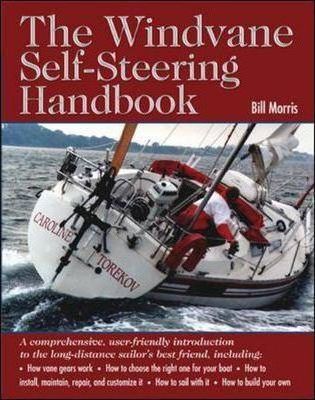
Wind Vane Self Steering Gear for Sailboats
Wind vane self steering, what you need to know if you want to make your own windvane for singlehanded and shorthanded sailing on your wooden sailboat.
Wooden Cabin Cruisers
Building or restoring cabin cruisers Tips and suggestions for fitting out and equiping your wood boat.
Green Boating with Uncle Charlie.
Green boating for my Uncle Charlie is nothing to do with any "trendy environmental initiatives" but just an old fashioned, frugal way of living and a love of sailing old wooden boats.
Marinas with Uncle Charlie.
Uncle Charlie and family avoid marinas not only because of the cost but because there is always an audience.
The Tao of Wooden Boat Sailing and Boat Building.
For my Uncle Charlie the Tao of boating isn't a consciously practiced Zen, neither does he regard himself as spiritually enlightened yet he has a self contained harmony a Yin Yang balace.


This work is licensed under a Creative Commons Attribution-ShareAlike 2.0 UK: England & Wales License.
I am perfectly aware that the majority of Wooden Boat aficionados are sensible folk.
However, I need to point out that I am an amateur wooden boat enthusiast simply writing in order to try to help other amateur wooden boat enthusiasts.
And while I take every care to ensure that the information in DIY Wood Boat.com is correct, anyone acting on the information on this website does so at their own risk.