- Home
- Your Boats
- GPS
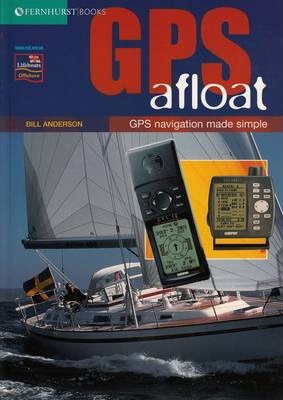
Marine GPS for Leisure Boating
Modern Marine GPS equipment has revolutionized leisure boating by helping to remove the fear and uncertainty inherent in traditional navigation.
Today, a small, relatively inexpensive, palm sized piece of electronic wizardry can give you your position on the earth’s surface with incredible accuracy
The Global Positioning System.

When
I
started navigating on my first little boat, way back
in the mists of time, the only electronic aids available were both
prohibitively expensive and of suspect accuracy on small boats.
Navigating at sea was done in the old-fashioned way, by DR chart work,
eyeball
fixes etc and on the open sea by Sextant, all of which had the
potential for
large errors the further one traveled.
Personally I rather enjoyed the process and calculations involved.
However, Marine GPS has now, thankfully removed most of the stress and anxiety from making a land fall, allowing us to plot our position to within an accuracy of ±10 meters.
And of course GPS is
not affected by the weather, so even in the
poorest visibility your GPS will still give you an accurate
position.
Not only has GPS has improved the efficiency of navigation but it has also improved safety at sea by making it possible to give a precise position to rescuers if, god forbid anything should go wrong.
GPS was first developed for the US Department of Defence.
The system uses between 24 and 32 satellites, each of which orbits the earth twice every day.
The first satellites were launched in 1978, and a second-generation of satellites was launched beginning in 1989 until the system became fully operational in 1995.
Each satellite constantly transmits data about its position
which the
GPS
receiver can use to calculate the reciever's position in relation to
that
satellite.
Once the receiver has data from three satellites it can calculate an
exact fix
of its position in Latitude and Longitude.
Add data form a fourth satellite and it can also calculate its altitude.
By storing and comparing the incoming data, the receiver can then easily calculate such things as the speed and the course made good, time between positions, estimated arrival time at the next waypoint, heading and a host of other useful information for the navigator.
Choosing a Marine GPS Set.
Marine GPS systems for the leisure boater come in a variety of setups, from the expensive fully integrated down to relatively cheap and simple handhelds.
Global Positioning Systems may have taken the uncertainty out of navigation but don’t throw away your charts.
Newer GPS models come out every year, packed with more and more features and they are also becoming more reasonably priced.
However, the more time you spend playing with these toys and the more you come to rely on them, the less will be your connection to the environment you are out there to enjoy.
My own personal preference is for something that is simple, easy to tread and above all easy to understand and set up.
Screen size should be considered when purchasing your next marine GPS unit.
The screen might be easily read in the shop but will it be legible in poor light, at sea, when your eyes are tired?
A touch-screen that makes entering numbers and addresses easier might not be so effective when your hands are wet and stiff with cold.
The ability to enter 1,000 waypoints sounds impressive, but has anyone ever sat down and entered that many?
And how do they keep track of them all?
The range of alarm functions such as ‘Off Course’, ‘Shallow Water’, and ‘Anchor Drag’ can be a big help but there is no way I would want a disemboweled voice constantly butting in.
Improvements to versatility and design continue to rise at an alarming speed and Bluetooth, phones and other devices are incorporating GPS.So, when deciding which Marine GPS set to buy you will need to be sure what you are comfortable with.
If you are not into gadgetry and just want to enjoy boating, don’t let the sales talk persuade you into buying something too complicated.
Keep it simple, keep it rugged, and keep it cheap enough to be able to afford a spare as back up.
affiliate linksSetting up the receiver.
Setting up the newer marine GPS units is becoming less of a chore than it used to be.
However, operating manuals do still tend to appear to be written by geeks and often they are over complicated, with confusing instructions on some of the bells and whistles, which are rarely if ever going to be used.
The main thing that you should get right is setting up the correct reference coordinate system.#
Your set needs to be set to the same horizontal datum showing on your nautical charts.
And the vertical datum should be coordinated with your charts and depth sounder.
You may also need to feed in the height of your antenna above sea level.
Whether your charts show the depth in feet or meters, having everything set to the same reference will avoid confusion.
Using the proper horizontal datum will improve the accuracy of the data provided by your GPS.
Most modern charts use either the ’NADB3’ datum (North America) or the ‘W0S84’ datum (World Geodetic Survey).
Set your GPS to the one you most commonly use, some minor corrections may be necessary when plotting on the other chart datum, however, providing the charts are modern ones, this correction is very small.
Beware, on older charts the difference can be quite large depending on your location.
The latitude and longitude position shift can be as much as 500 yards/meters, quite a lot if you are trying to find a narrow passage in fog.
The best bet for anyone using GPS is to replace all those old charts with modern up to date versions.
affiliate linksCaveat.

Nowadays it is rare to find any boater who doesn’t have a marine GPS on board.
However, it shouldn’t be
assumed
that using a marine GPS is the answer
to
all your navigation problems.
But then the same could be said about the echo sounder, which is a must
have on
boats these days.
Yet,
in my home sailing area there is often a lot of silt being stirred
up by
the tidal stream, which often fools the depth sounder.
And an echo sounder won’t show you nature of the seabed the way the piece of tallow in the bottom of an old fashioned lead could.
However, they are both such great aids to navigation it would be foolish to ignore them but they should not be relied upon entirely.
To use your GPS effectively you should learn about the system’s
limitations and how to make simple checks to ensure the GPS information
is not
leading you into danger.
It should always be
used with reference to an up-to-date nautical paper chart.
Accidents still occur where a boat’s crew have blindly followed their
GPS
instructions with out regard for or understanding of the limitations or
because
of faulty input of information.
In practice the main danger in using Marine GPS to navigate, is
normally caused
by operator error.
It should always be backed up with a set of checks making use of
paper
charts your
compass
and your senses.
As with any navigational error they are especially dangerous when close
to
shore.
At sea it always pays to be just a bit sceptical.
Fortunately, as sets become more robust, it is becoming increasingly
unlikely
to ever find ourselves in a situation where the marine GPS has suffered
an
electronic failure.
And I sincerely hope that the system never has to be again shut down
for
military operations, as it was during the Kosovo and Iraqi conflicts.

- Magnetic Compasses
- Passage Planning
- Pilotage
- Marine Charts
- Buoyage
- Navigation
- Boating School
- Boating Holiday
- Cold Water Boating
"Setting the course, keeping the dead
reckoning up to date, and fixing the position by observations of the
celestial
bodies, call for nothing more than simple arithmetic, a little
geometry,
and
some dexterity in handling a sextant."
(Eric
Hiscock)
You might like these
Maritime Weather Patterns
Global weather patterns influence your local marine conditions, understanding how these work will help you to interpret forecasts, help to keep you safe and your boating enjoyable.
Digital Selective Calling (DSC)
Digital Selective Calling
Automatic Identification System AIS
Automatic Identification System AIS

Recent Articles
-
Reader's Boat Photos
Aug 23, 25 09:08 AM
 Gallery of Readers uploaded Photos
 -
The Sliding Bevel
Jun 19, 25 02:52 AM
 By Robin Gates
The Sliding Bevel: A Boatbuilder’s Tool for Precision
For angles other than the perpendicular of the try-square and 45 degrees of a mitre-square, the essential measuring tool is a slidin…
-
Winter Bilge Issues
Jun 18, 25 07:34 AM
 By Adrian Morgan
Winter Bilge Issues: Can a Classic Boat Spend Too Long Ashore?
Beware the score of too long ashore, Adrian Morgan warns us…
Continue reading "Winter Bilge Issues"
You might like these
Cold Water Boating
Safety precautions for cold water boating and winter sailing
How to Mooring Your Boat.
Avoid embarrassment when Mooring and Docking, learn how to get it right safely with the correct lines and at least appear competent.
Anchor Types
Anchor types, how to choose the type, size and style of ground tackle, chain and rode to anchor your boat safely.
Anchoring Techniques
Anchoring techniques, best practices to ensure the safety of you and your boat, and how to retrieve a snagged hook.
Boat Winches
Boat Winches, sheet, anchor, halyard and trailer winches for Wooden boats
Wind Vane Self Steering Gear for Sailboats
Wind vane self steering, what you need to know if you want to make your own windvane for singlehanded and shorthanded sailing on your wooden sailboat.
Wooden Cabin Cruisers
Building or restoring cabin cruisers Tips and suggestions for fitting out and equiping your wood boat.
Green Boating with Uncle Charlie.
Green boating for my Uncle Charlie is nothing to do with any "trendy environmental initiatives" but just an old fashioned, frugal way of living and a love of sailing old wooden boats.
Marinas with Uncle Charlie.
Uncle Charlie and family avoid marinas not only because of the cost but because there is always an audience.
The Tao of Wooden Boat Sailing and Boat Building.
For my Uncle Charlie the Tao of boating isn't a consciously practiced Zen, neither does he regard himself as spiritually enlightened yet he has a self contained harmony a Yin Yang balace.


This work is licensed under a Creative Commons Attribution-ShareAlike 2.0 UK: England & Wales License.
I am perfectly aware that the majority of Wooden Boat aficionados are sensible folk.
However, I need to point out that I am an amateur wooden boat enthusiast simply writing in order to try to help other amateur wooden boat enthusiasts.
And while I take every care to ensure that the information in DIY Wood Boat.com is correct, anyone acting on the information on this website does so at their own risk.