- Home
- Cruising
- Navigation
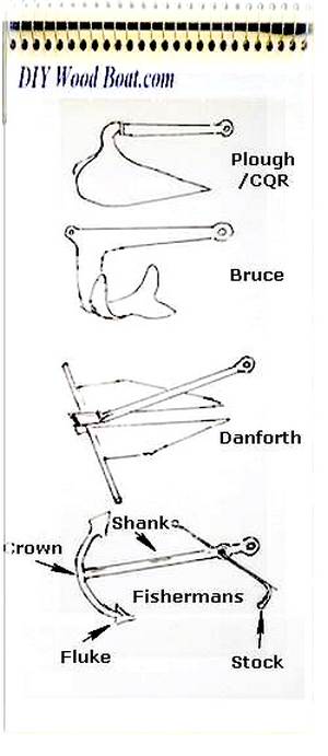
- Anchors
- Anchoring
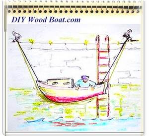
- Mooring
- Life Jackets
- Marine First Aid
- Marine Weather
Marine Weather Prediction.
Marine Weather forecasts need to be interpreted to make informed, localized decisions on the day.
Most of us nowadays, depend for our forecasts on National Meteorological services.
However, these services can rarely predict local conditions exactly.
And much of the weather that affects leisure sailors tends to be rather small scale.
We should also re-learn how to read the physical weather signs which our modem life has left us out of touch with.
Marine
Weather Forecasts.

Anyone
putting out to
sea, especially in small
boats needs to understand how best to use and understand marine weather
forecasts.
Getting the forecasts is
not a problem, the
mainstream media issue general predictions, marine forecasts, including
severe
marine weather warnings, are broadcast on radio by coastguard and other
agencies. Marine Weather
However, none of them
are
infallible.
And large bodies of
water and indented
coastal areas can be susceptible to highly variable local weather
conditions.
In order to interpret forecasts and adapt them to local conditions you will need to recognize the limitations of the various types of forecast and have a basic grasp of meteorological knowledge.
The first job is to know
what marine weather
forecasts are available and appropriate for your area.
The mainstream media
forecasts are very
general and cover large areas and are more concerned with the
conditions on
land, however they can be used to get a feel for general weather
patterns.
Local marine forecasts
are updated several
times a day, but even Inshore Waters Forecasts are predicted in general
terms
rather than in detail.
There are different ways
in which forecasters
interpret the data.
Short term forecast,
such as those for the
next 24 hours, are normally the result of a human forecaster using his
or her
experience to interpret the output from computers.
Longer term forecasts
tend to come straight
from computer modeling.
And how the initial data
is processed and
modeled can differ between the various centers.
So while some boaters
have their favorite
source of forecast information it does pay to look at several forecasts
to
arrive at a consensus view.
Then, adding your own
personal experience and
knowledge of local conditions you will be able to make more useful, if
not
necessarily accurate, short term decisions.
Weather forecasts can be received at sea using RTTY, Navtex and Radiofax.
affiliate linksBasic Knowledge.
Once you
know the basic
terms
used you will be able to interpret the broadcast information in a more
informed
way.
Since the establishment
in 1853 of the
International Meteorological Organization, now known as World
Meteorological
Organization the units used for wind
speed, pressure and wind direction
have
been standardized.
Synoptic pressure charts
are also a
standardized method of showing large scale atmospheric pressure
variations.
Being able to use and interpret synoptic charts is another invaluable way to get a feel for the way the weather is developing.
The
Barometer.

The
Barometer is one of those instruments, which like the magnetic compass
require
little or no maintenance, no external power and yet can be of immense
value to
those on board.
Barometric pressure and
its tendency to
change is the basic information that forecasts are based upon.
Barometric data collated
from a network of
weather stations are used by forecasters to create synoptic weather
maps.
By drawing Isobar lines
between points of
equal pressure on a map or chart a contour map showing variations in
pressure
is produced.
When this is combined with wind and other observations and the changes over time are observed, reasonably accurate forecasts can be made.
The aneroid type of barometer which is most commonly found on small boats provides a valuable indication pressure tendency, forecasting short term changes in the weather.
Generally high pressure
is an indicator of
fair weather while low pressure means that storms are more
likely.
However
it is the
movement, the rising and falling and the rate of change which is more
important
to the seafarer and is why barometer reading are normally recorded in
the
ship’s log.
A
large change in pressure
will not only herald a large change in weather it will also mean an
increase in
the wind strength.
A drop in pressure is a
sign of a low
pressure system approaching bringing with it a good chance of
rain.
On the other hand a rise in pressure will generally accompany clearing skies and an improvement.
affiliate linksShort term local forecasting.
If
we
were to combine
all the information
from the latest computer forecasting output with our own observations
of
today’s marine weather we should be able to accurately predict the
local
conditions for the following few hours.
Many of these smaller
localized features are
too small to be resolved by the computer models.
So for the small boater
there is considerable
benefit in being aware of how just observing sky conditions can be used
to
forecast weather.
Unfortunately our modern
lifestyles have
reduced our awareness of and feel for the natural signs and indicators
of
change in the atmosphere.
For
centuries folk have
been using the
simplest of methods for forecasting tomorrow conditions upon their
observations
of today’s conditions.
Many of the sayings
and weather
lore that they used while being based on simple observation
do have a basis
in scientific fact.
And quite often the folk
who relied on them
were seafarers whose very lives depended on them.
So, rather than
dismissed these old sayings
as meaningless perhaps it is time to reassess them and use them as a
basis for
our own observations.
I'm sure everyone is
familiar with the saying
"red sky at night, sailor's delight, red sky in the morning a sailors
warning” but there are a host of others which are worth
remembering.
Do you have a favorite Marine Weather Proverb, perhaps one passed down from a grandparent?
Local effects.
For the coastal sailor
the effect on the
prevailing marine weather caused by the local topography can be
dramatic.
Wind speed, for example, can dramatically increase and be deflected
from the
prevailing direction as it is funneled through narrow channels.
Even along open stretches of coastline the wind direction can be
deflected.
Cliffs can produce localized turbulence, and the gust form an
unexpected
direction can be caused by valleys or clefts in the cliff face.
Any coast fringed by high ground will be subject to localized phenomena
such as
kabatic winds.
Wind over tide can cause short steep waves.
And sea breezes will modify the prevailing conditions depending on the
time of
day.
A good sense of observation will help you keep track of weather shifts
over the
short term.
But predicting the affects of local conditions on Marine Weather requires an understanding of how and why these variations are produced.
NATIVE ASYNC


Recent Articles
-
Wooden Boat Events 2024
Apr 14, 24 05:15 AM
Wooden Boat Events 2024 calendar, traditional and classic boat festivals and regattas from around the world
You might like these
Rule of Twelfths for Quick Tidal Estimates
The rule of twelfths and the rule of tenths are easy rule of thumb calculations for quickly working out the approximate tidal stream and tide height from marine tide table predictions.
Weather Sayings
Weather sayings, worth remembering, sailors use phrases, expressions and idioms for short term forecasting, many have scientific explanations.
Maritime Weather Patterns
Global weather patterns influence your local marine conditions, understanding how these work will help you to interpret forecasts, help to keep you safe and your boating enjoyable.


Recent Articles
-
Wooden Boat Events 2024
Apr 14, 24 05:15 AM
Wooden Boat Events 2024 calendar, traditional and classic boat festivals and regattas from around the world -
14’ 1956 Chris Craft, side rail how should it be attached?
Apr 12, 24 03:38 AM
 Removing the old side rail most of the screws went between the top deck/skin 1/4” plywood and the side of the hull. See photo, is this correct? I would
 -
How to laminate plywood on the hull
Apr 10, 24 03:46 AM
I'm working on replacing the bottom of 18' 1969 runabout that has a deep-V plywood hull. It had a 1/2 mahogany plywood bottom that they somehow got to
You might like these
Anchor Types
Anchor types, how to choose the type, size and style of ground tackle, chain and rode to anchor your boat safely.
Cruising in Wooden Boats, the Eco Lifestyle
Freedom wooden boat Cruising, adventure, boat handling, navigation safety for wood boat builders.
Anchoring Techniques
Anchoring techniques, best practices to ensure the safety of you and your boat, and how to retrieve a snagged hook.
DIY Boat Yards
DIY boat yards, do you know of or are looking for facilities and hard standing where wooden boats are welcome and where owners can do their own thing free from bureaucratic harassment.
Passage Planning for Small Boat Cruising
Passage Planning, a concise and easily understood cruise plan, for any of voyage from a dinghy trip around the bay to, cruising boat navigating an ocean.
Free Energy
Free Energy, electricity on board your boat and battery charging from the wind or solar a comparison.
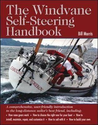
Wind Vane Self Steering Gear for Sailboats
Wind vane self steering, what you need to know if you want to make your own windvane for singlehanded and shorthanded sailing on your wooden sailboat.
Foraging for Shellfish
Foraging for Shellfish, the original fast food, for taste, nutrition and availability, edible seafood from the seashore is hard to beat.
Overcoming Seasickness
How to overcome seasickness, mal de mer or motion sickness a review of some of the remedies, medications and natural precautions.
Edible Seashore Plants and Seaweed
Edible Seashore Plants and Seaweeds are free for the forager to gather, they tasty, nutritious foods that provide the perfect accompaniment to any seafood dish.


This work is licensed under a Creative Commons Attribution-ShareAlike 2.0 UK: England & Wales License.
I am perfectly aware that the majority of Wooden Boat aficionados are sensible folk.
However, I need to point out that I am an amateur wooden boat enthusiast simply writing in order to try to help other amateur wooden boat enthusiasts.
And while I take every care to ensure that the information in DIY Wood Boat.com is correct, anyone acting on the information on this website does so at their own risk.