Buoyage Systems for Coastal Navigation.
All Buoyage marks are there for your guidance.
They carry safety guidelines within their color codes and shapes, it is in your interest to learn the codes.
However, marks can be moved, so keep your charts up to date.
Despite the efforts of the local authorities, there can be occasions when buoys drift off station, depths can change and lights can go out.
The prudent skipper will keep his eye on the depth and the chart as well as the buoys.
IALA Buoyage Systems.
The
International Association
of Lighthouse Authorities (IALA) was set up in 1979 to try to implement
a
universal system of buoyage world wide.
They were able to standardize everything except for the colors of lateral marks.
So, we now have two IALA systems of buoyage.
IALA System A uses red as the color for port hand lateral marks.
IALA System B uses red as the color for the starboard hand lateral marks.
Everything else, including the shape of the lateral marks is now the same world wide.
The IALA buoyage system's Region B covers the Americas and areas of the world with American influence such as Japan, Korea and the Philippines.
Region A covers the rest of the world including Europe.

Lateral Marks

Lateral marks are those which indicate the edge of a safe water channel.
The direction of buoyage dictates how these are set.
The direction of buoyage for all areas covered by the IALA is always is always set in an upstream direction.
The direction is always from the open sea into a harbor, estuary, bay or whatever.
Where there might be any confusion, it will be labeled on the appropriate chart and may be clarified with a cardinal mark.
While the color of the lateral marks may differ across the two region the shape across both remains the same.
In both regions the port hand lateral marks are square (cans) or have a flat top.
The starboard hand marks are conical or triangular in shape and have a pointed top.

These lateral marks may also display identification markings or names and distinctive light identification signals.
These will indicated on your marine chart.
Preferred Channel marks are a modification of the standard lateral mark.
They usually indicate a deep water channel, suitable for heavy commercial traffic, with a secondary channel suitable for shallower draught vessels to the side.
These are identified by a colored (red or green) horizontal stripe.
All the other buoys in the IALA system are the same regardless of which region they are in.
Cardinal Marks.

Cardinal marks are
common to all buoyage
systems.
They
indicate the
safe or deepest water side of a hazard.
The cardinal mark's name tells us which side the deepest water
lies.
For instance, one should always pass to the north of a North Cardinal
mark as
the deepest water lies in a 45 degrees quadrant to its north.
And stay to the east of the East Cardinal, south of the South Cardinal
and west
of the West Cardinal.
Each mark is distinguished by the pattern of its horizontal yellow and
black
stripes, the arrangement of the top-marks and light signals.
There are several tricks you can use to remember their characteristic identifiers.
Perhaps the easiest to remember and the most important is the flashing light sequence, at night it will be the only one visible.
If you think of the diagram above in term of a clock face, north is at 12 o'clock, east at 3, south at 6 and west at 9.
The east cardinal (at three o'clock) flashes in groups of 3 separated with a blackout.
The southerly flashes in groups of 6, the west cardinal flashes in
groups of 9
while the northerly mark flashes continuously.
The speed of the flashing can be either (Q) quick, or (VQ) fast
flashing, this
will be indicated on your chart..
A (Q) flashing light has 50/60 flashes per minute while a (VQ) light
has
100/120 flashes per minute.
They all flash a white light.
During the day the cardinals can be identified by the arrangement of the black and yellow stripes and the black, cone shaped top-marks.
The arrangement of cones at the top is an indication of the black
stripe (or
stripes) position on the buoy.
The north cardinal has both cones pointing up and the black stripe is
always at
the top.
The south cardinal has both cones pointing down and the black stripe is
at the
bottom.
The westerly mark has the cones pointing towards each other so it
appears the
have a narrow waist (waisted woman of the west has a black belt).
And there is a black stripe across the middle of the mark.
The east is opposite with the cones pointing away from each other and
the black
stripes are at the top and bottom.
It is reasonable easy to remember the different cone shapes, however it is worth the effort to remember the color codes as these are much easier to distinguish at a distance.
Isolated Danger Mark.

Buoyage
marks Isolated danger marks are also common across both IALA
regions.
They indicate that there is a hazard directly below the mark, such as a
wreck.
These are usually isolated dangers around which the water is safe to
navigate.
They are easy to identify with their horizontal black and red stripes.
The top-marks are two black spheres one above the other.
They also have a white flashing light signal but in groups of 2, Fl(2) with a black out between.
Safe water Mark.
The safe water mark is
the only one
with vertical stripes.
The stripes are red and
white and it will
also have a red sphere as the top-mark.
They indicate that water
is safe for
navigation all around the mark.
They may be used to mark
fairway approaches
or forks in a chanel.
When fitted with a light
it is usually white
however it may be isophase, occulting (rhythmic flashes of equal length
where
the period of light is longer than the dark) or flashing the Morse code
letter
"A".(dot dash).
Special Marks.
The IALA buoyage system also includes the special marks.
They are not so much navigational aids as indicators of special areas or objects mentioned on the charts or other nautical and publications.
They can be of any shape but are always painted yellow and have a yellow light which will be distinctive from other lights in the area.
The top-mark is optional but is usually a yellow X.
Transit or Range Markers.
Range or transit markers
are often found on waterways
with particularly shallow patches and or with cross currents.
They do not come under the IALA system of buoyage and so can be
anything from a
couple of withes (simple poles) to a set of lights.
They are always found as a pair with one higher than the other.
They are there to help you to keep to the center line of a channel.
The back marker is always higher than the front one.
The idea is keep the two in line while in the channel.
To keep the pair in line always steer towards the lower front marker.
You also need to watch for the normal buoyage marker which signals the end of that stretch of the channel where you will need to turn.
Sector Lights.
Sector Lights as with
range
markers are designed to help keep you in a safe navigational area.
The light emitted from a single position will show up as either red,
white or
green depending on the angle.
Every light is set up specifically for that particular area but its
specifics
will be clearly marked on the chart.
Depending on the color of the light that he can see the navigator can
tell
which sector he is in.
Like the range markers they indicate the safe area of a channel or
confined
waterway but as with range markers they cannot indicate where the
channel
ends.
So, you also need to watch out for other buoyage marks and refer to your chart.
NATIVE ASYNC

Previous posts
See What Others Have Posted
Students in BSAC Club
I am running a chartwork and position fixing course for my BSAC branch using BSAC programm.
I have been looking at different sites for the student …

Recent Articles
-
Wooden Boat Events 2024
Apr 14, 24 05:15 AM
Wooden Boat Events 2024 calendar, traditional and classic boat festivals and regattas from around the world
"An
incorrectly identified mark is a hazard,
not an aid, to navigation"
(Alton
B. Moody)
You might like these
Rule of Twelfths for Quick Tidal Estimates
The rule of twelfths and the rule of tenths are easy rule of thumb calculations for quickly working out the approximate tidal stream and tide height from marine tide table predictions.
Weather Sayings
Weather sayings, worth remembering, sailors use phrases, expressions and idioms for short term forecasting, many have scientific explanations.
Maritime Weather Patterns
Global weather patterns influence your local marine conditions, understanding how these work will help you to interpret forecasts, help to keep you safe and your boating enjoyable.
VHF Marine Radio
Description of VHF Marine Radio Equipment for the average boater, types of transceiver, range and restrictions.
Tides, how they are caused and predicted.
Tides, tidal streams, sea level predictions and marine currents and what the leisure boater should know about Tide tables, charts coastal height prediction data.
Tide Gates and Navigation.
Tide gates, currents, overfalls and tide races what to watch out for when planning coastal navigation.
Polaris the Navigator's Star
How to use Polaris to determine the direction of north, probably the oldest form of celestial navigation in the northern hemisphere.
Pilotage Planning, the Art of Coastal Navigation
Pilotage planning, tips and techniques for small boat, inshore navigation, buoy hopping, night sailing and entering and leaving port.
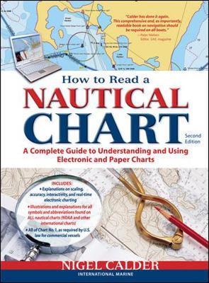
Marine charts for Navigation.
Marine charts are essential for boat navigation a sea either as paper charts or electronic charts for the information the navigator must have.
Tidal Stream Vectors for Boat Navigation.
Tidal stream and currents, how they affect boat navigation, estimating position and determining course to steer


You might like these
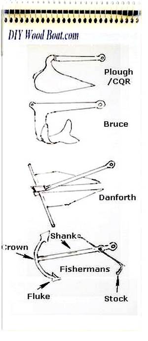
Anchor Types
Anchor types, how to choose the type, size and style of ground tackle, chain and rode to anchor your boat safely.
Cruising in Wooden Boats, the Eco Lifestyle
Freedom wooden boat Cruising, adventure, boat handling, navigation safety for wood boat builders.
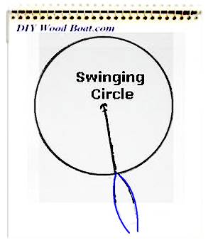
Anchoring Techniques
Anchoring techniques, best practices to ensure the safety of you and your boat, and how to retrieve a snagged hook.
DIY Boat Yards
DIY boat yards, do you know of or are looking for facilities and hard standing where wooden boats are welcome and where owners can do their own thing free from bureaucratic harassment.
Passage Planning for Small Boat Cruising
Passage Planning, a concise and easily understood cruise plan, for any of voyage from a dinghy trip around the bay to, cruising boat navigating an ocean.
Free Energy
Free Energy, electricity on board your boat and battery charging from the wind or solar a comparison.
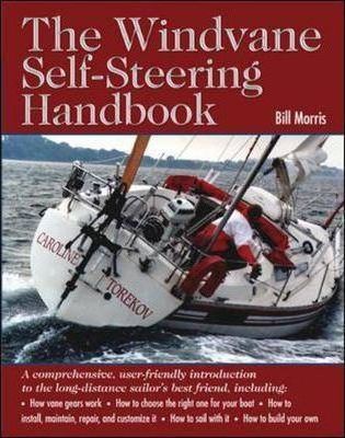
Wind Vane Self Steering Gear for Sailboats
Wind vane self steering, what you need to know if you want to make your own windvane for singlehanded and shorthanded sailing on your wooden sailboat.
Foraging for Shellfish
Foraging for Shellfish, the original fast food, for taste, nutrition and availability, edible seafood from the seashore is hard to beat.
Overcoming Seasickness
How to overcome seasickness, mal de mer or motion sickness a review of some of the remedies, medications and natural precautions.
Edible Seashore Plants and Seaweed
Edible Seashore Plants and Seaweeds are free for the forager to gather, they tasty, nutritious foods that provide the perfect accompaniment to any seafood dish.


This work is licensed under a Creative Commons Attribution-ShareAlike 2.0 UK: England & Wales License.
I am perfectly aware that the majority of Wooden Boat aficionados are sensible folk.
However, I need to point out that I am an amateur wooden boat enthusiast simply writing in order to try to help other amateur wooden boat enthusiasts.
And while I take every care to ensure that the information in DIY Wood Boat.com is correct, anyone acting on the information on this website does so at their own risk.